


iGeoTrans is a perfect solution to replacing dedicated handheld GPS navigation devices for iPhone, iPad and iPod touch users. It supports surveying, mapping, fieldwork and related fields for any area in the world.
______________
KEY FEATURES:
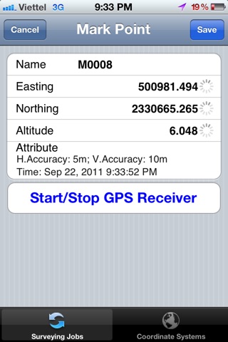
- Locates users location with high accuracy.
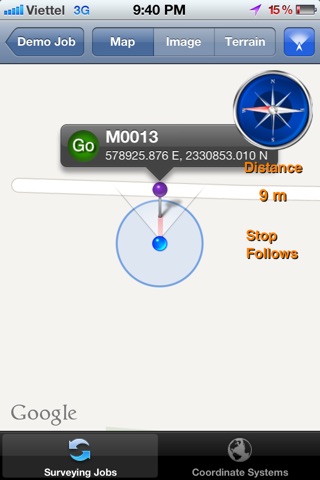
- Allows users to manage and load waypoints, displaying straight route from users location to the selected waypoint on the map in real time.
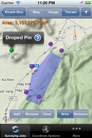
- Allows users to compute the area or distance directly on the map
- Displays direction, digital compass, route and the straight-line distance between users location and the selected waypoint on the map in real time.
- Users can manage the reference coordinate systems by adding, removing, and updating them.
- Geodetic data in a reference coordinate system can be transformed to those in another with high accuracy (there are 7 parameters for datum transformations between a user-defined coordinate system and WGS 84 Global definition and vice versa or among the user-defined coordinate systems).
- Converts geodetic coordinates to map grid coordinates and vice versa using one of 26 different map projections for any area in the world.
- Easily imports or exports waypoint coordinates in different coordinate systems and input formats.
___________________________________
Were always happy to help our users and receive their comments! To ensure a direct response from us, please send your bug report or feature requests to [email protected]. We hope you will consider leaving a 5 star rating and a positive review on iTunes.
SUPPORT: [email protected]
The GPS in iGeoTrans IS ONLY AS ACCURATE AS YOUR devices built-in GPS.
Facebook: http://www.facebook.com/iGeoTrans/
Better performance on iOS 6 with iPhones (3GS, 4, 4S, 5, 5S, 5C) and iPad (2, 3, 4, mini).